
Collection Item
Mining
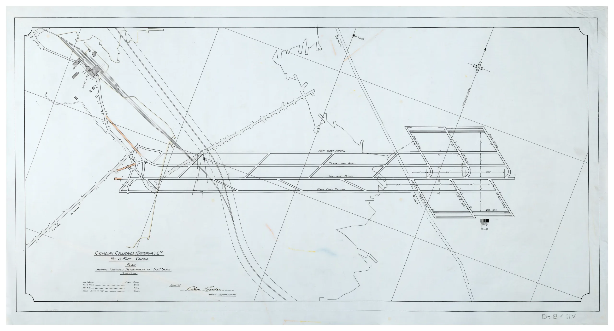
Map of proposed development of No. 2 seam of No. 5 mine, 1924
Type: Document
Date: 1924
History
This is a plan of a proposed development to the No.5 mine's No.2 seam. The mine began operations in 1895 and continued on and off until 1947. This shows the tipple of the No. 5 mine and the underground structures and tunnels necessary to further develop the seam. The various seams were once highlighted in different colours but the colours have since faded.
Description
1 map: white and black. 1 Inch = 100 Feet Projection = Astronomic North
Item Details
- Materials: vellum (paper)
- Classification: Category 8: Communication Objects > Documentary Objects > Graphic Documents > cartograph > map
- Accession Number: 994.001.033
- Author: Canadian Collieries (Dunsmuir) Ltd.
- Donor: Pozzalo, Joe
- Donated: 1994-01-05
- Size: 119 x 64 cm
- Credit: Digitized with the assistance of the British Columbia History Digitization Program and the Canadian Heritage Museums Assistance Program. Thank you for your support.


