
History
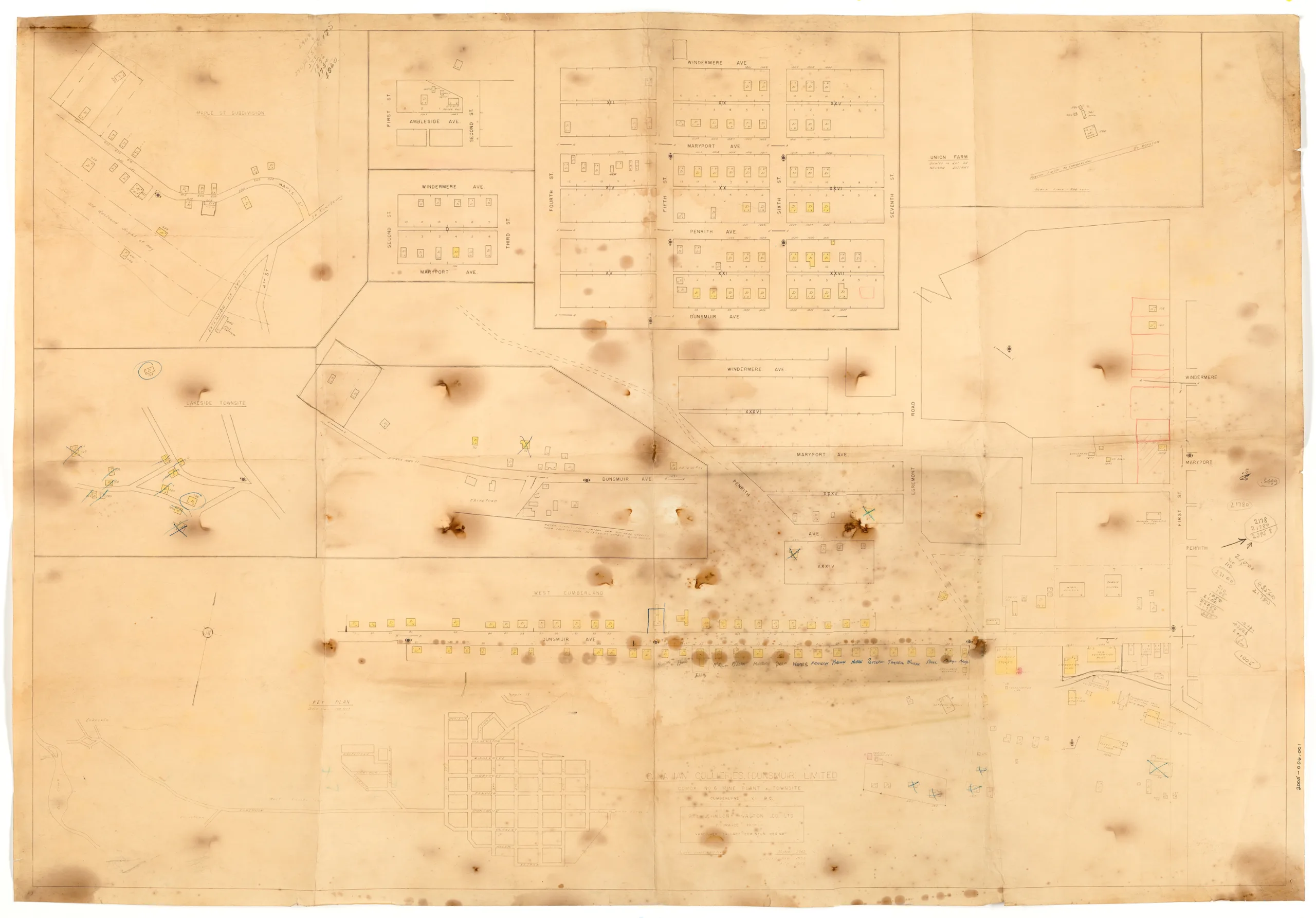
This is a map of the No.6 surface operations and townsite (Cumberland). It is an insurance style of map used by a broker to assess property. It was created initially in 1952 then revised several times in 1953 and 1955. It shows properties owned by Canadian Collieries (Dunsmuir) Ltd. in various areas of Cumberland as well as properties in Chinatown, Comox Lake ("Lakeside townsite"), and a location labelled Union Farm. There are many markings on the map, with some properties highlighted, crossed out, or circled. Names are listed below the properties in west Cumberland indicating who lived there.
The map is fragile and littered with burn marks from the acid in the paper.
Description
1 map: buff and black. 1 Inch = 100 Feet
Item Details
- Materials: paper (fiber product)
- Classification: Category 8: Communication Objects > Documentary Objects > Graphic Documents > cartograph > map
- Accession Number: 2005.006.001
- Author: B.L. Johnson & Walton Co. Ltd.
- Donor: Trew, George
- Donated: 2005-10-26
- Size: 116 x 80 cm
- Credit: Digitized with the assistance of the British Columbia History Digitization Program and the Canadian Heritage Museums Assistance Program. Thank you for your support.


