map-bg

Land, Indigenous peoples, settlers, and today’s communities.

Since time immemorial, Ancestors of the people called K’ómoks today consisting of the Pentlatch, Ieeksan (eye-ick-sun), Sasitla (sa-seet-la), Xa’xe (ha-hey) and Sathloot (sath-loot) people have been the caretakers of this land, which they called the “Land of Plenty.” This Land of Plenty stretched from what is known today as Kelsey Bay in the north, down to Hornby and Denman Island in the south, and included the watershed and estuary of the Puntledge River, also acknowledging that these boundaries and place names are colonial constructs.

The K’ómoks First Nation refer to the lands between the bays of Comox and the Beaufort mountain range as the path between, it was a travel and trade route to the Alberni corridor and a connection to the indigenous communities on the western side of the island.

Land agreements included the 1884 Settlement Act stripped these lands for its caretakers. At the Museum we acknowledge that we are a colonial created institution, and I would like to thank Charlene Everson, Emily Shopland and Violet Williams for guiding the museum in early discussion on what reconciliation could mean for our organization and how we could create actionable steps; in maintaining a positive dialogue with a forward focus, sharing contemporary K’omoks narratives, and incorporating First Nation languages where they felt it appropriate. Their time and guidance helped us gain insight and learn how to best support their voice in our museum’s walls. This is an ongoing process and we have so much more to learn.

Collection Item
Community

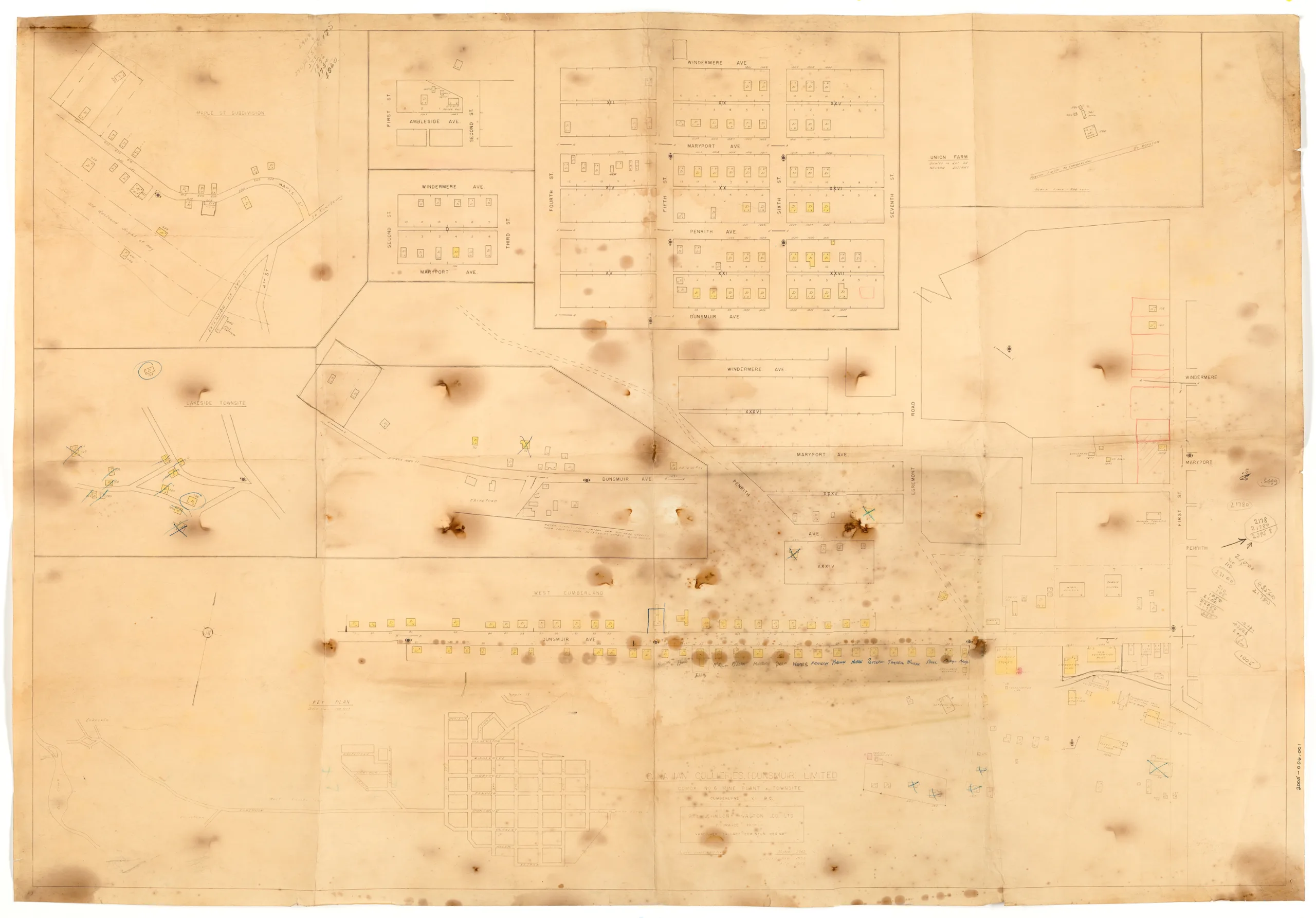
Map, No.6 mine plant and townsite

Type:

Date: February, 1955

History

This is a map of the No.6 surface operations and townsite (Cumberland). It is an insurance style of map used by a broker to assess property. It was created initially in 1952 then revised several times in 1953 and 1955. It shows properties owned by Canadian Collieries (Dunsmuir) Ltd. in various areas of Cumberland as well as properties in Chinatown, Comox Lake ("Lakeside townsite"), and a location labelled Union Farm. There are many markings on the map, with some properties highlighted, crossed out, or circled. Names are listed below the properties in west Cumberland indicating who lived there.
The map is fragile and littered with burn marks from the acid in the paper.

Description

1 map: buff and black. 1 Inch = 100 Feet

Item Details