History
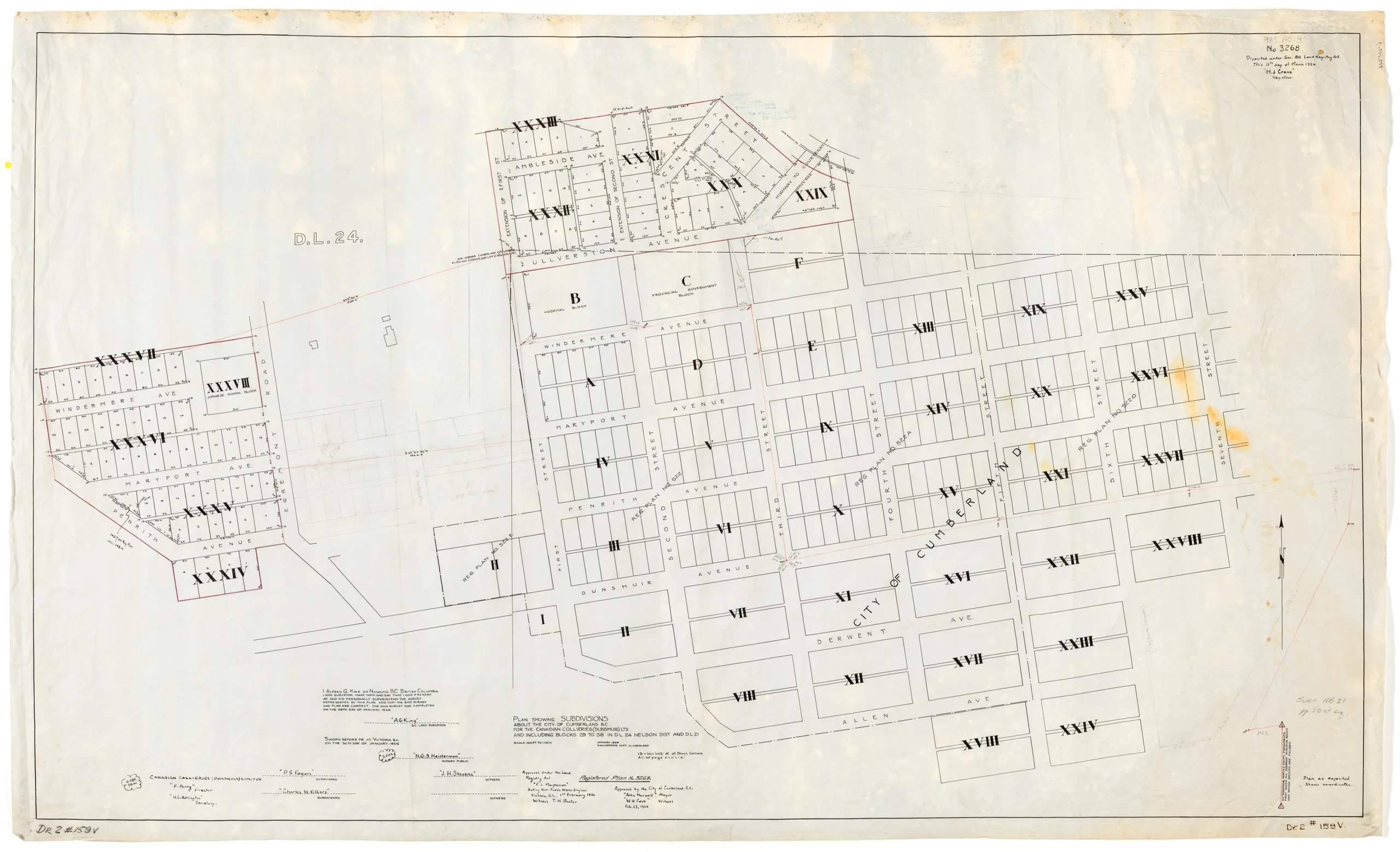
Registered plan no. 3268 of the City of Cumberland subdivisions, including blocks 29 to 38 in Nelson District DL. 24 and D.L. 21, as they appeared in 1926. Lots start from Windermere Avenue in the west to Seventh Street in the east, with Ambleside and Allen as the north and south limits. Further lots in between Egremont Road and First Street have been sketched in in pencil at a later date, possibly in the 1940s or 1950s.
Locations of note include Lot B which was the location of the former Cumberland Hospital, and the Japanese School Block in Block XXVII between Windermere Avenue and Egremont Road.
The map was created by the Engineering Department of the City of Cumberland, superintended by Alfred G. King, and was approved by Alex Maxwell, mayor of Cumberland.
Description
1 map: vellum, white and black.
100 feet = 1 inch.
Item Details
- Materials: vellum (paper)
- Classification: Category 8: Communication Objects > Documentary Objects > Graphic Documents > cartograph > map
- Accession Number: 983.140.009
- Author: City of Cumberland, Engineering Department.
- Donor: Douglas, Stan
- Donated: 1983-09-03
- Size: 130 x 79 cm
- Credit: Digitized with the assistance of the British Columbia History Digitization Program and the Canadian Heritage Museums Assistance Program. Thank you for your support.


