History
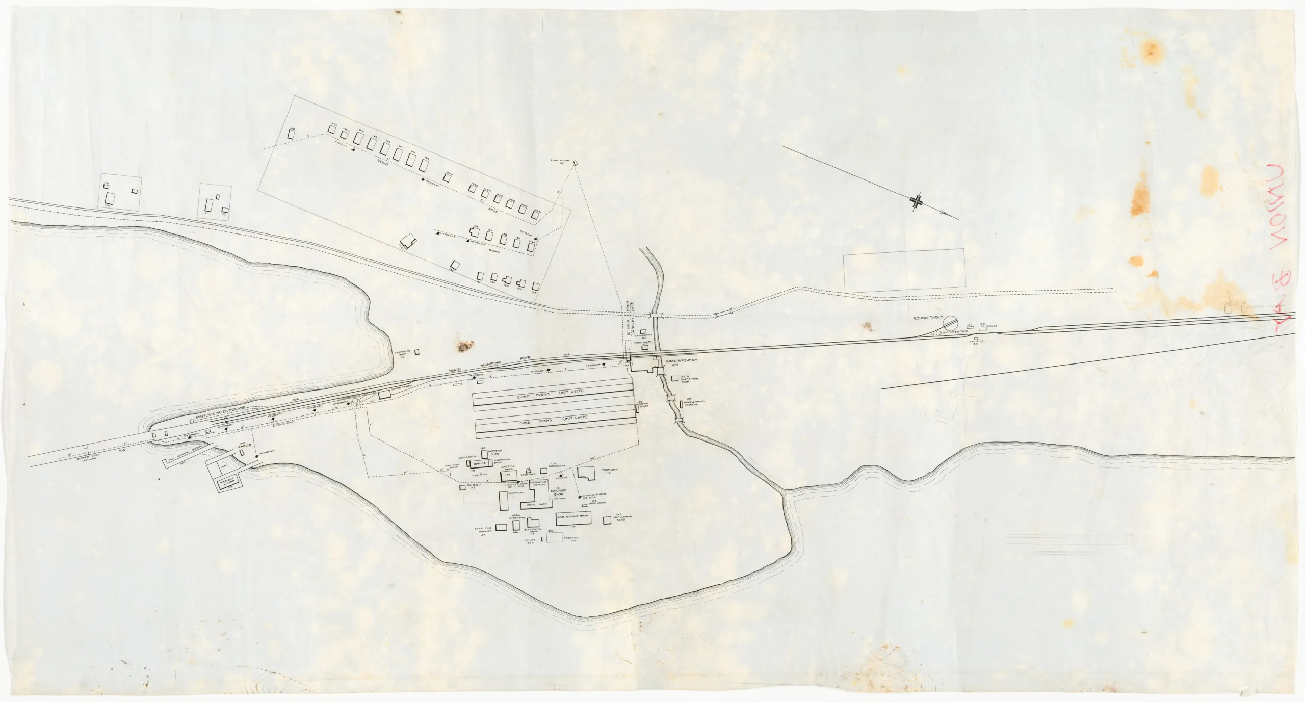
This is a map/drawing of the Wellington Collieries Railway shops, coke ovens, workers residences and part of the coal loading pier. There is no title information or scale although it looks like these were in the process of being lined in. "UNION BAY" is hand written in red ink on the reverse side of the map’s upper left corner. The map appears to be incomplete. The road pictured is now the Old Island Highway (Route 19A).
Union Bay was the shipping point for coal produced from the Cumberland mines from the opening of the wharves in 1889 until 1953. The coke ovens were built in 1895, 1899, and 1917. In 1919 coke oven production ended. On the drawing, both rows of coke ovens are labelled as "not used", indicating that it was drawn sometime after the end of production.
Description
1 map: velum, white and black. Projection = Astronomic North
Item Details
- Materials: vellum (paper)
- Classification: Category 8: Communication Objects > Documentary Objects > Graphic Documents > cartograph > map
- Accession Number: 2015.087.001
- Donated: 2015
- Size: 136 x 73 cm
- Credit: Digitized with the assistance of the British Columbia History Digitization Program and the Canadian Heritage Museums Assistance Program. Thank you for your support.