map-bg

Land, Indigenous peoples, settlers, and today’s communities.

Since time immemorial, Ancestors of the people called K’ómoks today consisting of the Pentlatch, Ieeksan (eye-ick-sun), Sasitla (sa-seet-la), Xa’xe (ha-hey) and Sathloot (sath-loot) people have been the caretakers of this land, which they called the “Land of Plenty.” This Land of Plenty stretched from what is known today as Kelsey Bay in the north, down to Hornby and Denman Island in the south, and included the watershed and estuary of the Puntledge River, also acknowledging that these boundaries and place names are colonial constructs.

The K’ómoks First Nation refer to the lands between the bays of Comox and the Beaufort mountain range as the path between, it was a travel and trade route to the Alberni corridor and a connection to the indigenous communities on the western side of the island.

Land agreements included the 1884 Settlement Act stripped these lands for its caretakers. At the Museum we acknowledge that we are a colonial created institution, and I would like to thank Charlene Everson, Emily Shopland and Violet Williams for guiding the museum in early discussion on what reconciliation could mean for our organization and how we could create actionable steps; in maintaining a positive dialogue with a forward focus, sharing contemporary K’omoks narratives, and incorporating First Nation languages where they felt it appropriate. Their time and guidance helped us gain insight and learn how to best support their voice in our museum’s walls. This is an ongoing process and we have so much more to learn.

Collection Item
Mining

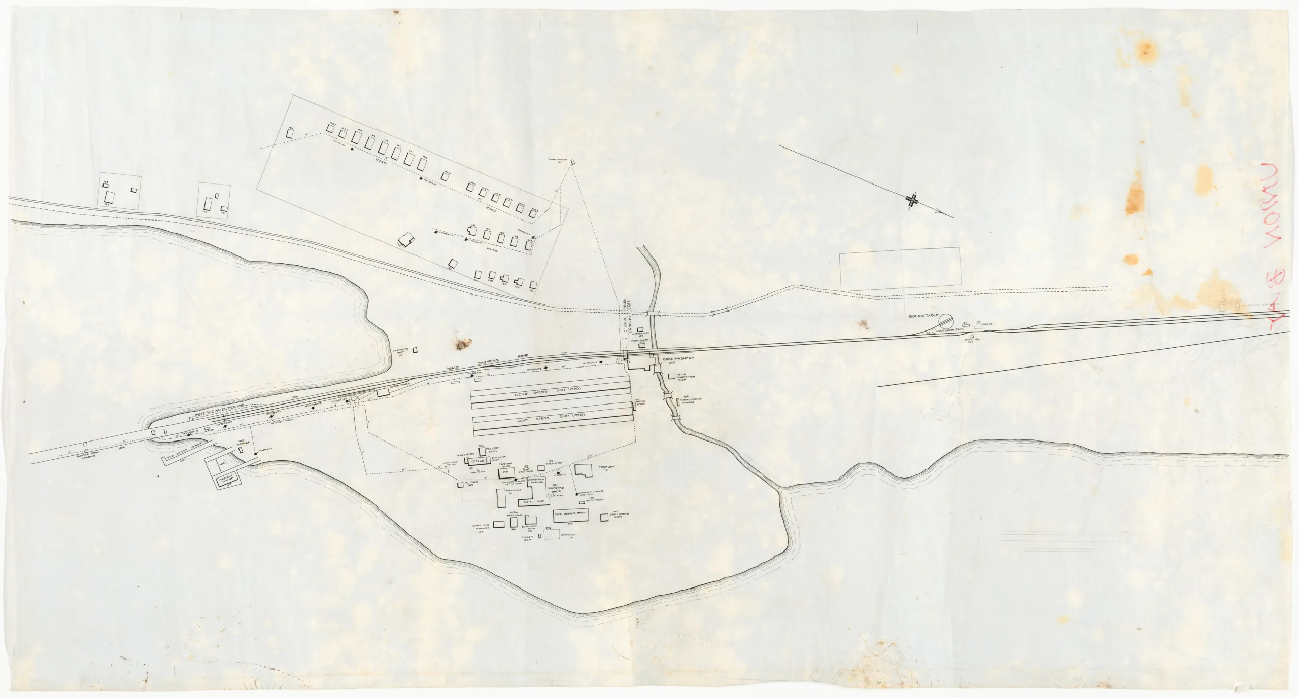
Map of Union Bay rail yards and shops

Type:

Date: c. 1920-1940

History

This is a map/drawing of the Wellington Collieries Railway shops, coke ovens, workers residences and part of the coal loading pier. There is no title information or scale although it looks like these were in the process of being lined in. "UNION BAY" is hand written in red ink on the reverse side of the map’s upper left corner. The map appears to be incomplete. The road pictured is now the Old Island Highway (Route 19A).
Union Bay was the shipping point for coal produced from the Cumberland mines from the opening of the wharves in 1889 until 1953. The coke ovens were built in 1895, 1899, and 1917. In 1919 coke oven production ended. On the drawing, both rows of coke ovens are labelled as "not used", indicating that it was drawn sometime after the end of production.

Description

1 map: velum, white and black. Projection = Astronomic North

Item Details