
Collection Item
Mining
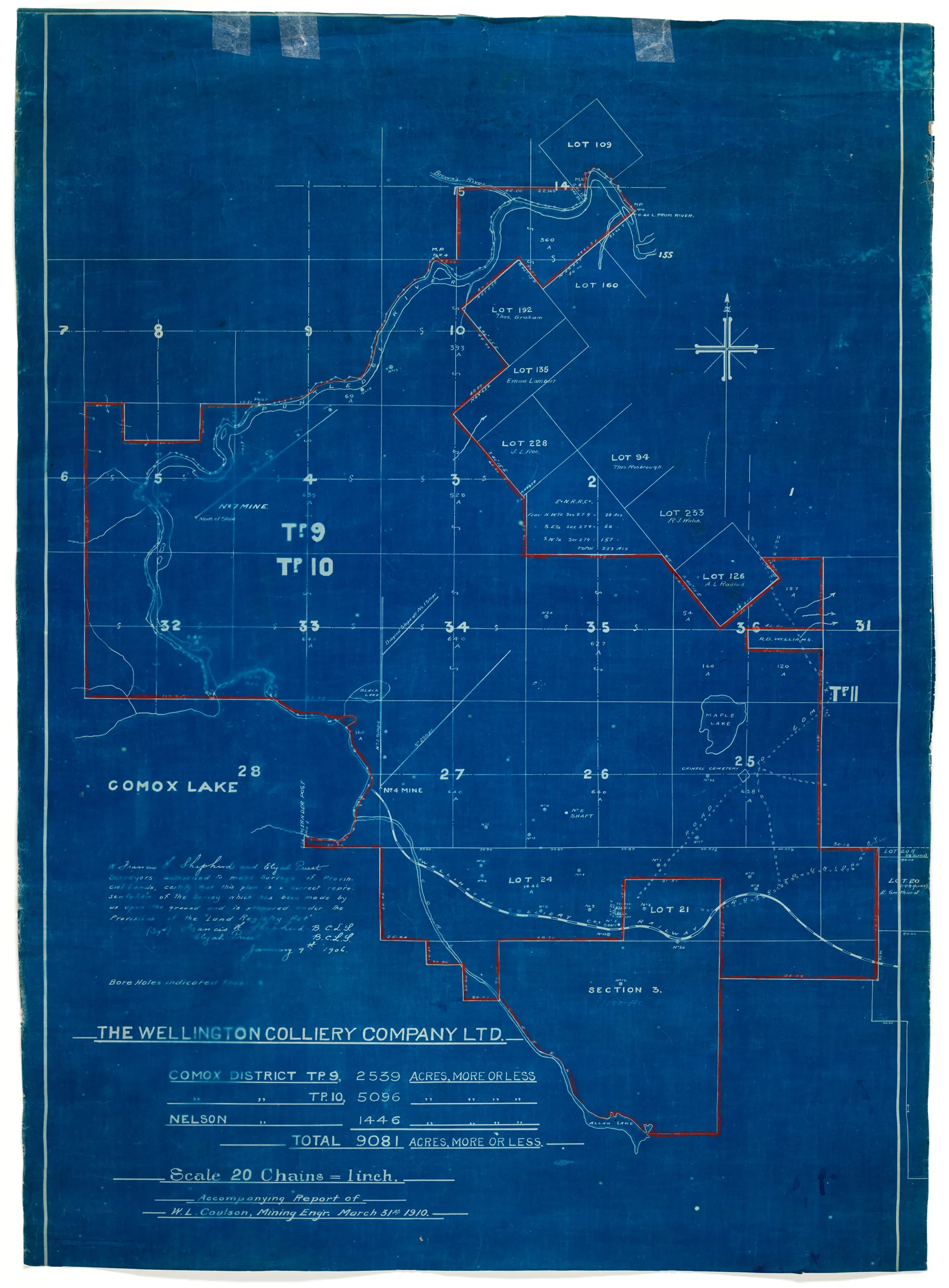
The Wellington Colliery Company Ltd. plan, 1910
Type: Document
Date: 31 March 1910
History
This blueprint is of a map originally surveyed in 1906 by Francis L. Shepherd and Elijah Prust, and was reproduced for a report by mining engineer W. L. Coulson in 1910. The map shows locations of No. 4, No. 5 No. 6 and No. 7 mines as well as boreholes for testing. It covers the areas of Townships 9 and 10 of the Comox District and the upper part of Nelson District. Lots bordering the area outlined in red are labeled with their owners' names.
The Wellington Colliery Company became the Canadian Collieries (Dunsmuir) Ltd. in 1910.
Description
1 map: blue and white.
20 Chains = 1 inch
Item Details
- Materials: paper (fiber product)
- Classification: Category 8: Communication Objects > Documentary Objects > Graphic Documents > cartograph > map
- Accession Number: 990.033.001
- Author: Coulson, W.L. ; Shepherd, Francis L. ; Prust, Elijah
- Donor: Davis, Tab
- Donated: 1990-07-20
- Size: 62 x 86 cm
- Credit: Digitized with the assistance of the British Columbia History Digitization Program and the Canadian Heritage Museums Assistance Program. Thank you for your support.


